
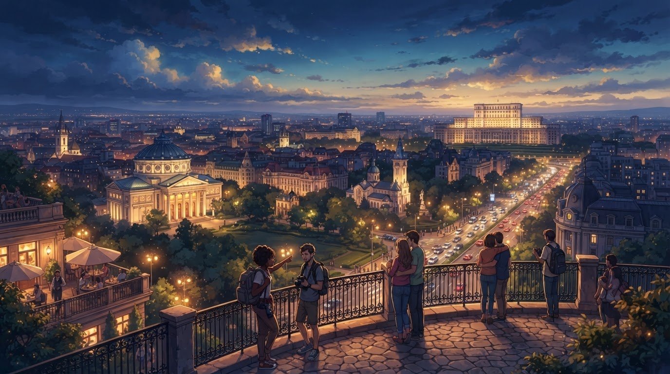
Romania’s Capital City: Bucharest’s Role in Culture and Economy
Bucharest is more than Romania’s political center: it’s Romania’s capital city and a major hub for the country’s culture and economy. It became the capital in 1862 and lies on the Romanian Plain, less than 60 kilometers north of the Danube River and the Bulgarian border.
Bucharest’s history, location, and city life make it a natural starting point for understanding Romania. As the capital, it plays a role beyond government, shaping the country’s cultural scene and economic activity.
This guide explains how Bucharest became the capital, where it lies on the Romanian Plain, and why it matters to Romania today. You’ll also learn about the landmarks and local character that bring its history to life, helping you decide what to explore.
Key Takeaways
- Trace how Bucharest’s early records and changing political role shaped its path to becoming Romania’s capital.
- Get a clearer sense of the city’s low-lying setting and what its position on the Romanian Plain means for its landscape.
- Explore landmarks and turning points that reveal how Bucharest’s history still shapes its cultural character.
- Understand why population figures can differ depending on whether they count the city itself or the wider metropolitan area.
- Use the city’s cultural and historical highlights to plan a visit that suits your interests.
What is the history of Bucharest as Romania’s capital?
Bucharest’s story spans its earliest recorded mention to its present-day role in Romania. Its history, weather, and transport connections can all help you plan a well-rounded visit.
Bucharest’s History and First Recorded Mention
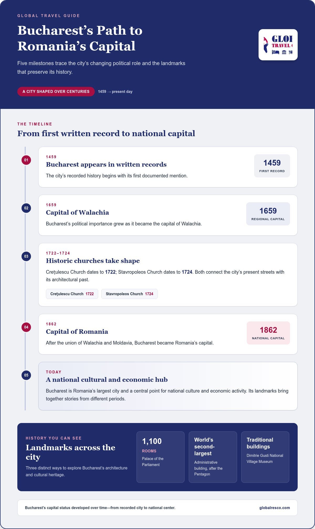
Bucharest’s recorded history begins in 1459, the first year it appears in written records. It later became the capital of Walachia in 1659, reflecting its growing political importance. These dates offer useful context when exploring the city’s historic streets and landmarks. They also show that Bucharest’s capital status developed over time, rather than beginning with modern Romania.
Bucharest’s Role as Romania’s Capital
Bucharest became Romania’s capital in 1862, after the union of Walachia and Moldavia. Today, it is the country’s largest city and a central point for national culture and economic activity. Its political role gives visitors a practical base for discovering museums, historic districts, and major institutions. As Romania’s capital city, Bucharest also brings together landmarks from different periods of the country’s past.
Several places make that history visible. The Palace of the Parliament has 1,100 rooms and ranks as the world’s second-largest administrative building after the Pentagon. The Dimitrie Gusti National Village Museum offers visitors a look at traditional buildings. Crețulescu Church dates to 1722, while Stavropoleos Church dates to 1724. Together, these sites offer distinct ways to explore Bucharest’s architecture and cultural heritage.
Bucharest also has four clearly marked seasonal patterns. Bucharest experiences seasonal temperature changes, so visitors may want to check the forecast before planning outdoor activities. Fall temperatures are around 60-70°F from September to October. Winter temperatures are typically 30-40°F from November to March. These ranges help visitors choose clothing and plan outdoor sightseeing.
The metropolitan area gives another view of the city’s scale. It covers 1,803 square kilometers and had a listed population of 2,333,293 people. Those figures describe a wider area than Bucharest’s city limits, so metropolitan and city population counts are not interchangeable.
Is Bucharest the largest city in Romania? Yes. Bucharest is Romania’s largest city by population.
What is Bucharest known for? Notable attractions include the Palace of the Parliament, historic churches, and the Village Museum.
What language is spoken in Bucharest? Romanian is the official language and the main language spoken in Bucharest.
What currency is used in Bucharest? Romania uses the Romanian leu, abbreviated RON.
How do you travel from Bucharest to other major Romanian cities? Trains and roads connect Bucharest with other major cities. The best option depends on your destination and preferred travel time.
What are the main attractions in Bucharest? Visit the Palace of the Parliament, the Dimitrie Gusti National Village Museum, and historic churches such as Stavropoleos.
Geography and elevation
Bucharest covers 239 square kilometers, with elevations ranging from 55.8 to 91.5 meters. These figures place the city’s geography in practical terms: it occupies a broad urban area with a relatively modest elevation range. For visitors, the city’s size matters more to daily plans than elevation. Neighborhood choice, distance between stops, and transport connections shape how easily you move around.
Bucharest’s elevation range provides useful context, but it doesn’t describe every street or neighborhood. The city’s lowest and highest points fall within the stated range, so a single elevation figure cannot capture its full profile. Think of Bucharest as a collection of districts, rather than one uniform point on a map, when planning routes to the places you want to see.
Bucharest sits on the Romanian Plain, giving the capital a lowland setting rather than a mountain location. The city is also less than 60 kilometers north of the Danube River and the Bulgarian border. Those geographic reference points help place Bucharest within southern Romania. They also clarify why the capital is a useful base for understanding the country’s southern landscape.
For practical orientation, distinguish the city’s footprint from its wider surroundings. The 239-square-kilometer figure refers to Bucharest itself, while the metropolitan area covers 1,803 square kilometers. These are different geographic measures, not competing estimates of the same boundary. A map may show the city beside a much larger ring of settlements, so check whether a destination is inside Bucharest or farther out.
The modest elevation span can help set expectations for getting around. It doesn’t mean every journey is short or that all districts feel alike. Distances across a city covering 239 square kilometers can still shape a day’s schedule. Group nearby museums, parks, and historic sites together, then allow travel time between separate areas. The location of each stop matters more than elevation alone.
Bucharest’s lowland location offers a clear geographic frame for comparing destinations. Consider whether your plans focus on urban neighborhoods, the Danube area, or places near the Bulgarian border. Each choice affects the distance and direction of travel. The city’s position on the Romanian Plain helps explain these relationships without confusing the capital’s boundaries with the wider region.
Use a map to compare the city center, your accommodation area, and planned attractions before setting each day’s route. For a broader trip overview, the Global Travel Guide can help you organize destinations and travel plans. Bucharest’s elevation range is a useful detail, but its 239-square-kilometer footprint and surrounding geography offer stronger clues for planning movement.
History and early records
Bucharest’s history is reflected in its old churches, public institutions, and changing streets. These landmarks connect the city’s present-day layout with political shifts over several centuries. Early religious buildings, in particular, show how local communities and rulers shaped the urban landscape before Bucharest became a modern capital.
Curtea Veche, or the Old Court, includes a church dating to 1559. The church of the former Antim Monastery dates to 1715. These buildings offer different examples of Bucharest’s religious architecture and historical layers. Their dates also help place surviving landmarks within a timeline, rather than treating the old center as one single period.
During Prince Constantin Brâncoveanu’s rule of Walachia, from 1688 to 1714, large thoroughfares were built in Bucharest. This period matters because roads and public spaces influence how a city grows. When exploring historic districts today, look beyond individual facades. The street pattern can also reflect earlier choices about movement and civic life.
Political change brought Bucharest into the center of national events. In 1821, the city was the focus of an uprising led by Tudor Vladimirescu, which ended Phanariote rule. Civic unrest in Bucharest in 1848 and 1859 also contributed to the union of Walachia and Moldavia. These events help explain why the city’s history is closely tied to Romania’s changing political structure.
Education and social reform added another layer. The University of Bucharest was founded in 1864, with roots in institutions dating to 1694. A land reform took place in Romania in 1864, while national independence followed the war of 1877-78. These milestones show how institutions and political developments expanded alongside the capital’s role.
The twentieth century brought a sharper transformation. Nationalization of business and industry in Romania began in 1948, followed by large-scale projects and marked architectural uniformity in Bucharest. Under Nicolae Ceaușescu, Bulevardul Unirii was vastly expanded in the 1980s. About 25,000 acres of old Bucharest were razed to make room for the new palace and grand boulevard.
This history helps explain Bucharest’s varied architecture. Earlier churches, such as the Old Court church, stand alongside urban spaces reshaped by large state projects. The contrast is more than a difference in building styles: it reflects political decisions and changing ideas about how the capital should look and function.
For visitors, these historical layers offer a useful way to explore. Compare the scale and setting of Curtea Veche with the broad route of Bulevardul Unirii. Notice how buildings, streets, and public institutions reflect different eras. The city’s landmarks are easier to understand when you consider their dates and historical context.
Location on the Romanian plain
Bucharest’s position on the Romanian Plain places the capital within southern Romania’s lowland landscape. The city lies less than 60 km north of the Danube River and the Bulgarian border. That relationship gives visitors a useful regional reference, beyond simply locating Bucharest on a country map. It helps distinguish the capital’s setting from Romania’s mountain regions and frames its connection with the south.
Think of the Romanian Plain as a broad geographic setting, not a boundary around Bucharest. The capital is an urban destination within this larger landscape, with the Danube and Bulgaria serving as reference points to its south. On a map, these relationships help you understand direction and regional context. They don’t mean that every place south of Bucharest is part of the capital.
The Danube is a useful reference point when planning a wider Romanian itinerary. It is a major geographic feature south of Bucharest, and the Bulgarian border provides another point of orientation. When comparing destinations, note whether each is in the capital, elsewhere on the plain, or closer to the river. This distinction makes your route clearer before you plan individual stops.
Bucharest’s lowland setting offers a different geographic experience from Romania’s mountain destinations. The plain provides a broad regional frame, while the capital brings together dense streets, neighborhoods, and cultural sites. These are different scales of travel: you might use Bucharest as an urban base and visit the Danube area as a separate part of a wider journey.
Use a map in stages. First, locate Bucharest within Romania. Next, find the Romanian Plain around the capital. Then identify the Danube and Bulgarian border to understand the city’s southern position. This approach separates national geography from local navigation and helps prevent a common planning mistake: treating regional landmarks as if they were city-center attractions.
When comparing destinations, consider what each offers your trip. Bucharest suits plans centered on an urban capital and its cultural life. The Romanian Plain describes the wider setting, while the Danube and Bulgaria help locate the city in southern Romania. These references can guide broad itinerary choices, but local transport and the location of each attraction shape how you get around Bucharest.
Bucharest’s position is a useful starting point for understanding how Romania’s regions relate to one another. The capital lies north of the Danube, not directly on the river. Keep this distinction in mind when comparing a city stay with a river-focused visit. The Romanian Plain provides the geographic context, while the Danube is a separate landmark south of the capital.
For a practical overview, mark Bucharest, the Danube, and the Bulgarian border as separate points. Compare each destination’s role in your itinerary before deciding where to spend time. This regional view clarifies the location of Romania’s capital without confusing the city limits with the wider Romanian Plain.
How many people live in Bucharest?
Bucharest’s population depends on the year and boundary used. Within the city limits, the 2011 census recorded 1,883,425 inhabitants. A later estimate put the city’s population at 1,713,832 people in January 2026. These figures describe different snapshots, so they should be read with their dates rather than treated as identical counts.
The difference between a census and an estimate matters. A census counts residents at a particular point using its own method, while an estimate describes population between census periods. Bucharest’s city-limit population also decreased between the 2002 and 2011 censuses. That historical change is one reason a population figure should always include its reference year.
Boundaries matter as much as dates. A figure for Bucharest proper counts people within the city limits, while a metropolitan or functional urban area covers a broader zone that includes nearby settlements. These wider totals answer a different question: how many people live in the connected area, rather than within Bucharest itself. Compare like with like when reading city profiles.
Density adds context to the headcount. Bucharest’s population density was 7,171 people per square kilometer. This measure describes how population is distributed across an area, not how many residents live in the whole city. It helps explain the urban scale, but it can’t show how crowded a particular street or neighborhood feels.
For travel planning, population figures provide background, not a prediction of conditions at every attraction. A large city can have busy central districts and quieter residential areas. Bucharest has six administrative sectors, so the area you visit can shape your experience. Consider where you stay and which places are on your itinerary rather than relying on the citywide population alone.
Use three details to interpret any Bucharest population figure: the reference year, the geographic boundary, and whether the number is a census count or estimate. For example, 1,883,425 refers to city-limit inhabitants at the 2011 census, while 1,713,832 is the January 2026 estimate. Keeping those labels attached prevents an outdated count from being mistaken for a current one.
Population data also helps compare Bucharest with other destinations, provided each figure uses a similar date and boundary. A city-limit count shouldn’t be compared directly with a metropolitan total. Keep the difference in mind as you plan your stay, then plan your Bucharest trip around the districts and attractions you want to experience.
GLOBAL TRAVEL GUIDE: Global Travel Guide
GLOBAL TRAVEL GUIDE can help turn your interest in Bucharest into a more organized trip plan. Use its Global Travel Guide to explore the destination, then consider Tours & Tickets, Flights, and Accommodation as you shape your visit. This is a useful next step once you’ve chosen what you want to see and need to bring travel arrangements together. For example, you can plan around Bucharest’s museums and historic districts, then decide which travel options fit your itinerary. Keep your preferred dates, attractions, and travel priorities in mind as you plan. Visit globalresco.com to explore your options.
Make Bucharest Your Next Discovery
Let what you’ve learned shape the kind of visit you want. Choose a few places that interest you, leave time to explore nearby streets, and plan each day at your own pace. Experiencing Romania’s capital through its history and everyday life can make a trip feel more connected than simply checking off landmarks.
GLOBAL TRAVEL GUIDE can help you plan with its Global Travel Guide, Tours & Tickets, and flight options. Use these resources to move from destination ideas to practical travel arrangements. Start with the experiences you’re most excited about, then build the rest of your plans around them.
Contact GLOBAL TRAVEL GUIDE for help as you plan your Bucharest visit. A little preparation can make it easier to look forward to the city and enjoy discovering it at your own pace.
Frequently Asked Questions
How is Bucharest important to Romania’s culture and economy?
Bucharest is a major center for cultural events, education, and economic activity in Romania. The month-long George Enescu International Festival brings classical music into the city’s cultural calendar, while the University of Bucharest adds an academic presence. Bucharest’s nominal GDP per capita was €58,716 in 2025. That figure describes economic output per person, not an individual resident’s salary, but it helps show the capital’s economic weight.
What is Bucharest?
Bucharest is Romania’s largest city and a municipality divided into six administrative sectors. Each sector offers a different way to organize a stay, from choosing accommodation to grouping nearby sights in one day. The city combines government, cultural institutions, universities, and everyday residential neighborhoods. For visitors, thinking of Bucharest as both a destination and a working city helps balance landmark visits with time for local streets and districts.
What is the capital city of Romania?
Bucharest is the capital city of Romania. Its national role makes it a useful starting point for travelers who want to understand the country before exploring other regions. The city brings together major cultural institutions and public life, while its six administrative sectors offer a practical way to orient yourself locally. For a first visit, choose museums, neighborhoods, or events that match your interests.
Where is Bucharest located in Romania?
Bucharest is in southern Romania, on the Romanian Plain. Henri Coanda International Airport is about 10 miles north of the city, a helpful reference when planning arrival and accommodation. The Danube and Bulgarian border lie south of the capital. These landmarks can help you orient a wider itinerary, while a city map is more useful for locating individual neighborhoods and attractions.
What is the weather like in Bucharest?
Bucharest has four distinct seasons, so choose clothing based on your travel dates. Spring and fall are generally milder, summer can bring hot days, and winter is typically cold. For outdoor sightseeing, plan walks earlier or later on hot summer days, and bring warm layers in winter. A light layer can also make spring and fall outings more comfortable as conditions change during the day.